
A ride report from the Grand Opening weekend.
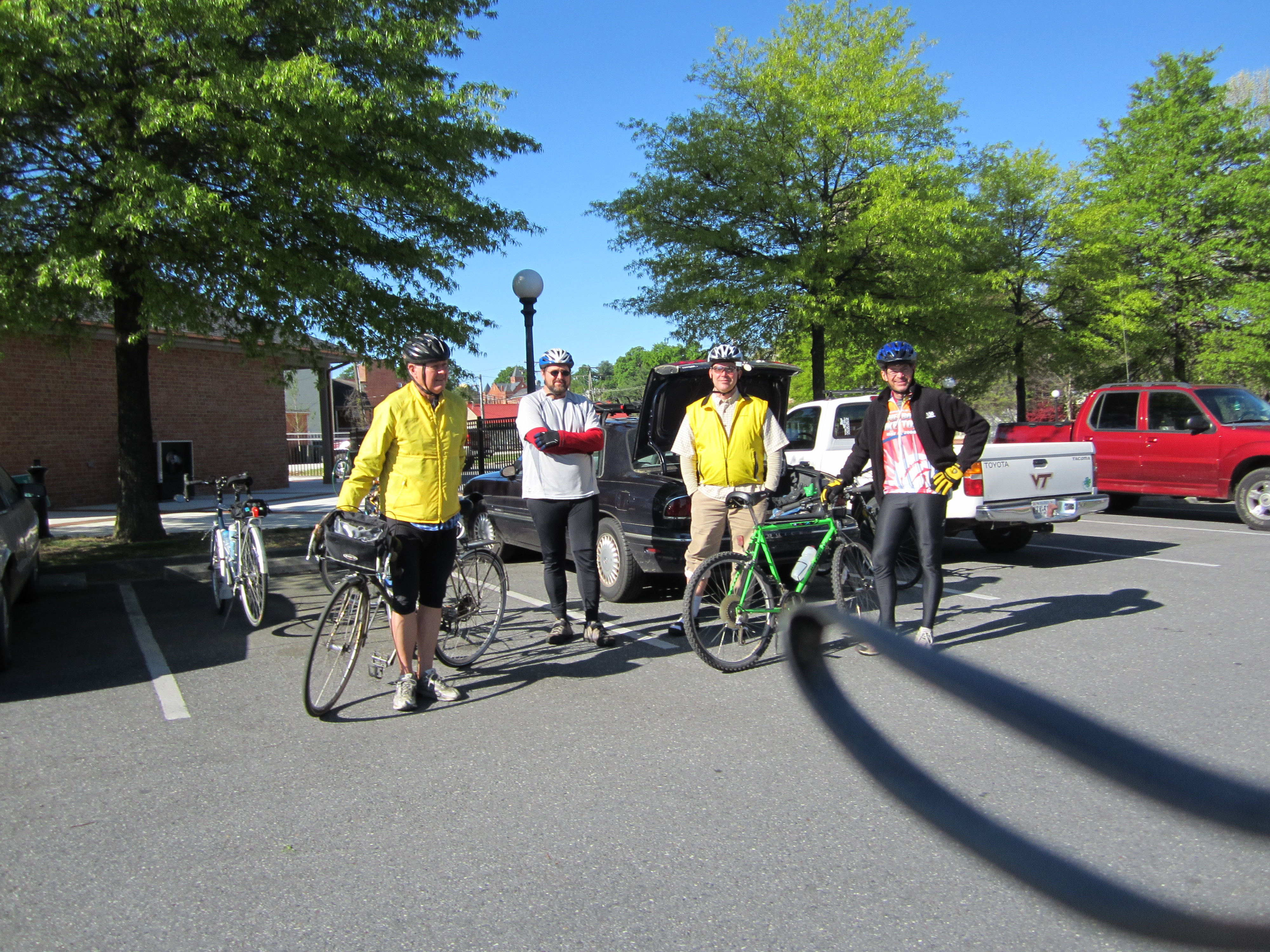
The rest of the High Bridge Trail State Park 31 mile long trail has been open for 18 months now, while the bridge itself has been undergoing its conversion from a railroad bridge to a bridge for hikers, bikers, and horseback riders. For months the word has been “Opening early April” and “Watch our website for the announcement”. Finally, on Monday, April 2nd the website announces that the bridge will open on Friday, April 6th. Hurriedly, the call goes out to the RABA list for a contingent to make the trip out to Farmville on Saturday to check out the eastern end of the trail, bridge and all. Four stalwarts, Rickey Davis, John Dawson, Joe Hazel, & Dale Peacock, answer the call and we meet at Main St. and the trail crossing in downtown Farmville at 9:30 a.m.
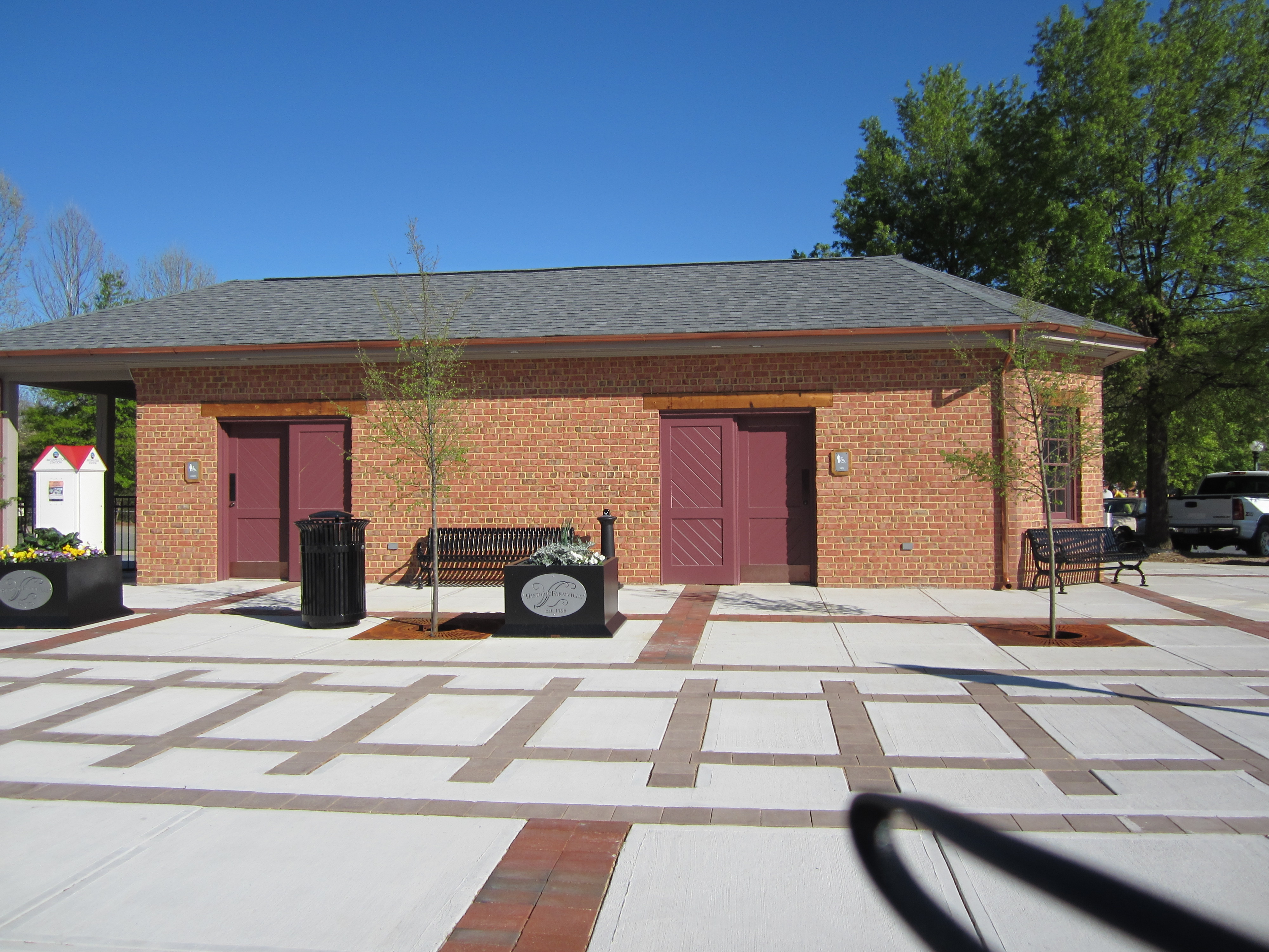
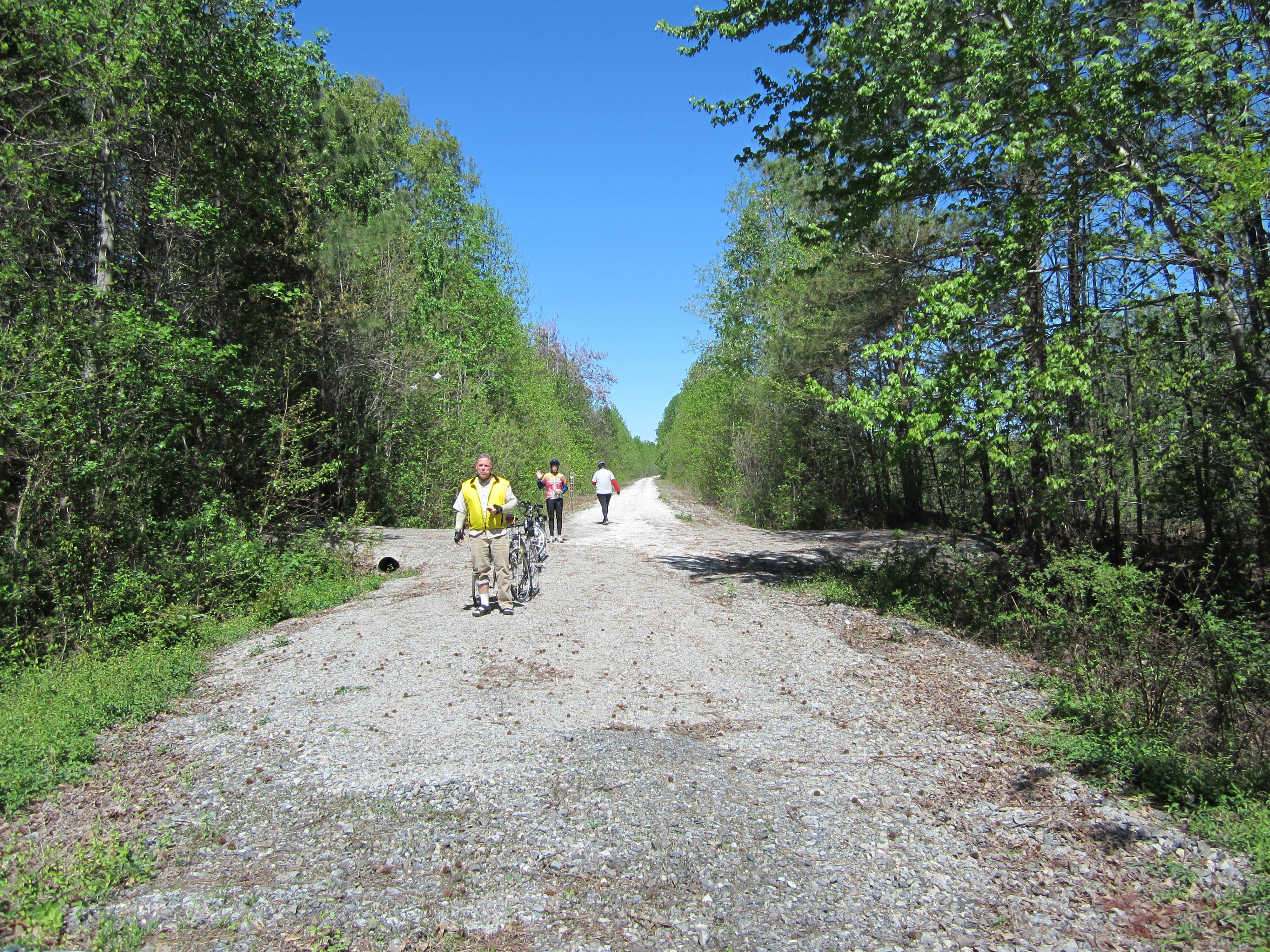
Immediately, we notice the nicely signed entrances to the trail both to the east and west, on either side of Main St. A building containing very nice rest room facilities is on the north side of Main, along with a picnic table, pipe sculpture in the form of a bicycle and a parking lot shared with the very popular Green Front Furniture store ( in a building that once housed a Craddock-Terry shoe factory) and Charley’s Waterfront restaurant where we plan to have lunch after the ride. After a passerby informs us that a Ranger Talk is scheduled for 10 out at the bridge, we mount our bikes and head out the eastern segment of the trail, where the sign indicates 4.4 miles to the bridge. Right away, I notice that the trail is hard packed, fine gravel, rather than the crushed limestone I had encountered on a previous trip on the western segment of the trail. Our small party is riding the whole range of bikes from my road bike with 1” tires to hybrids and mountain bikes with fatter tires, and all seem to be suitable for the surface.
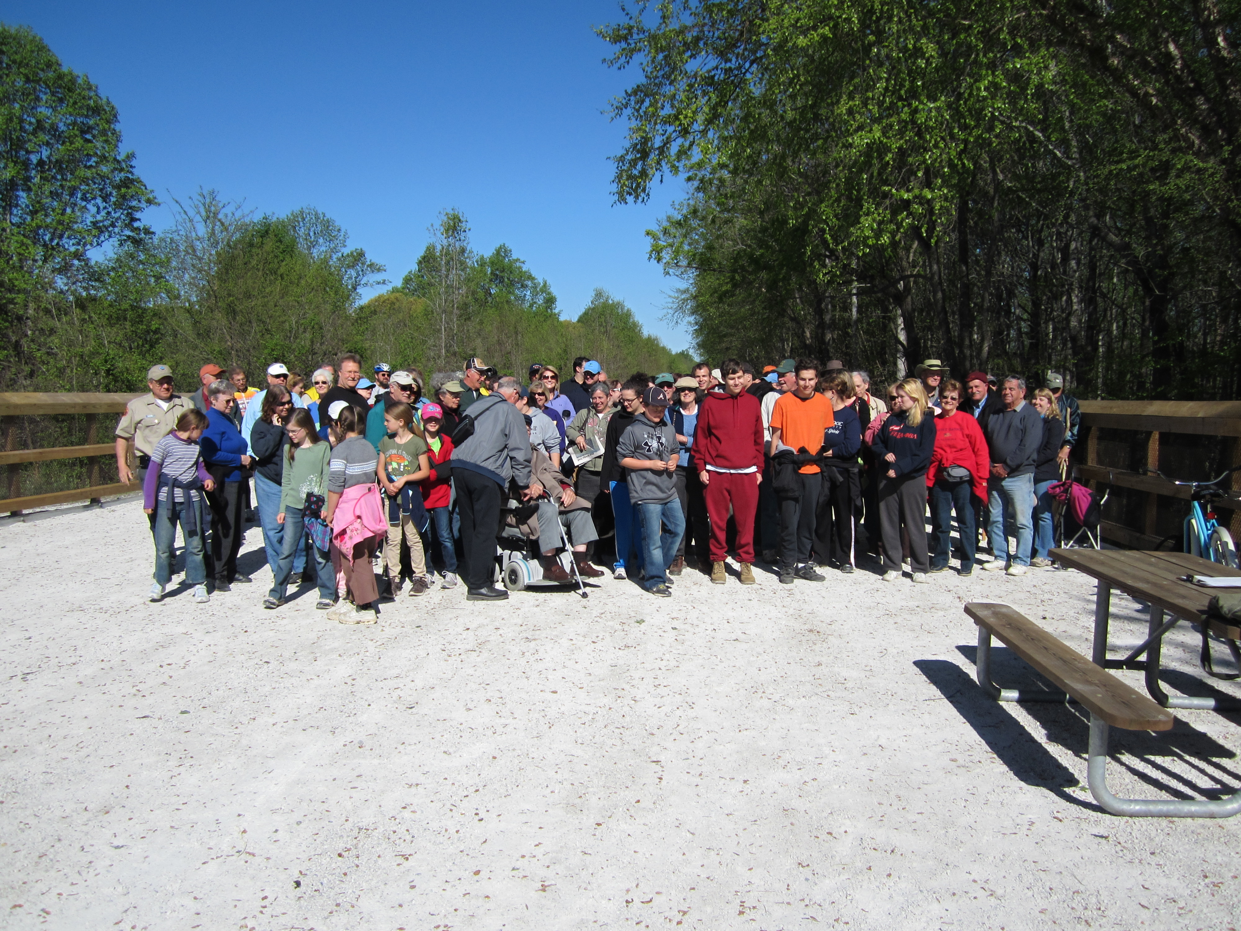
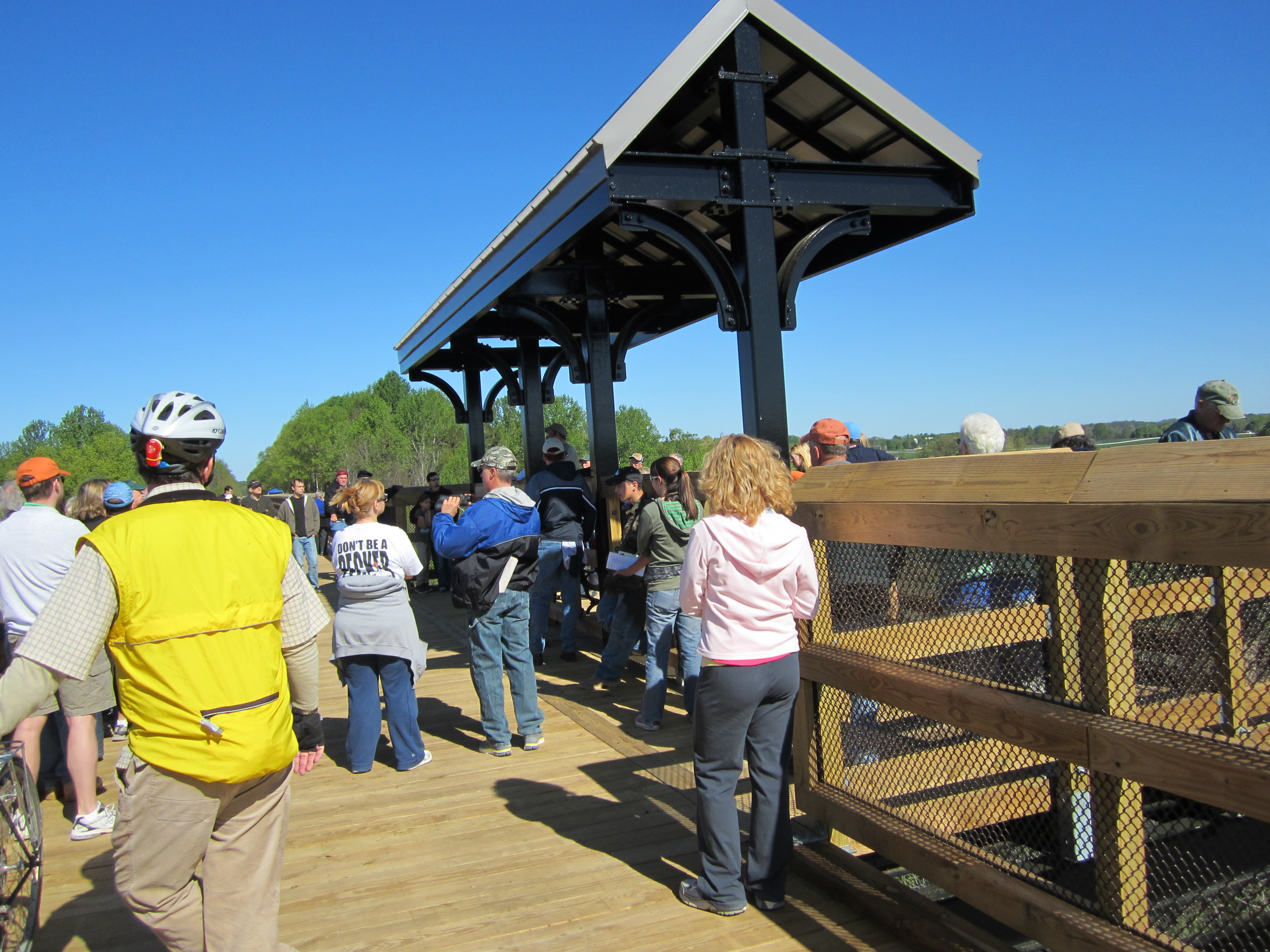
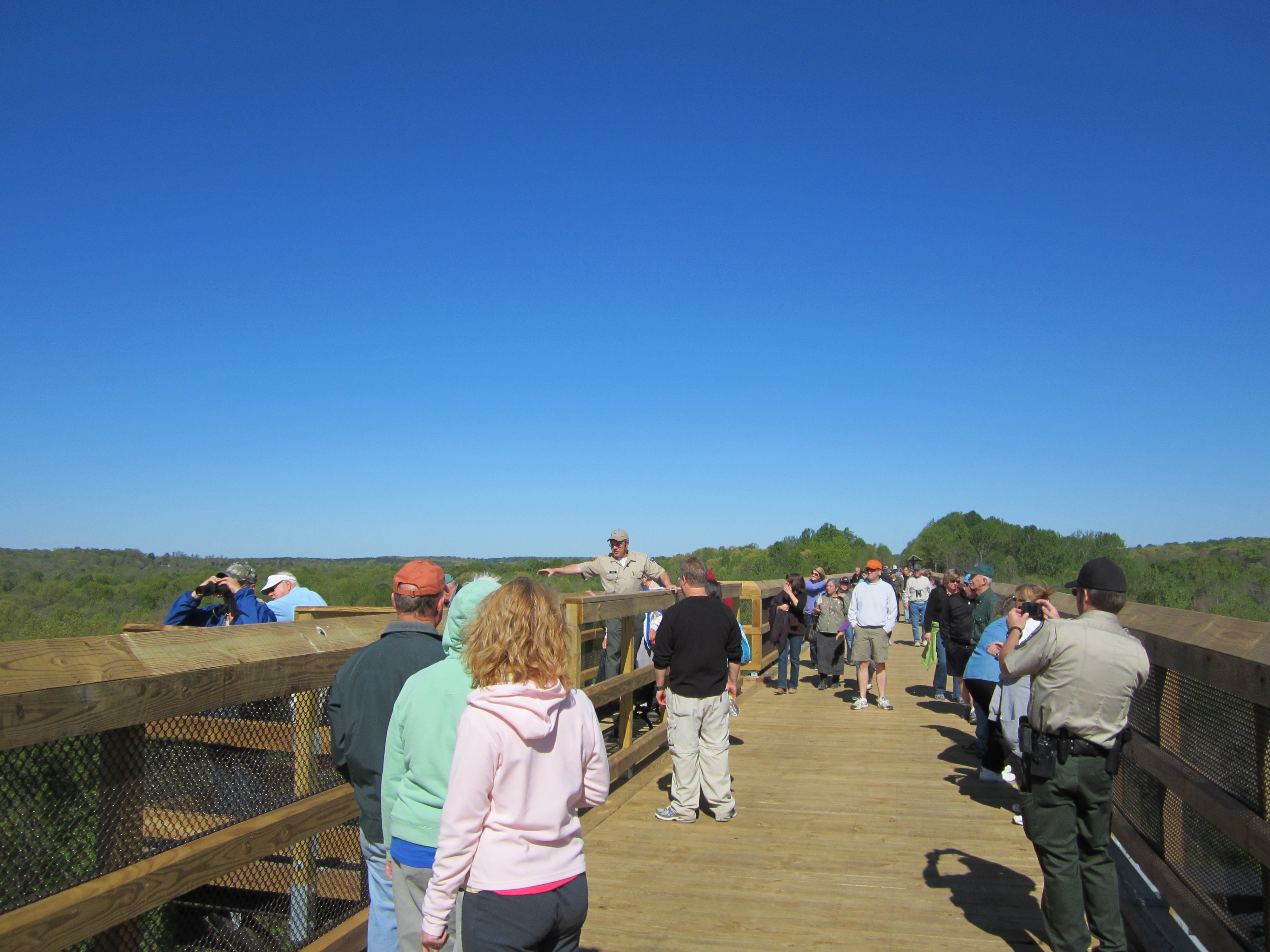
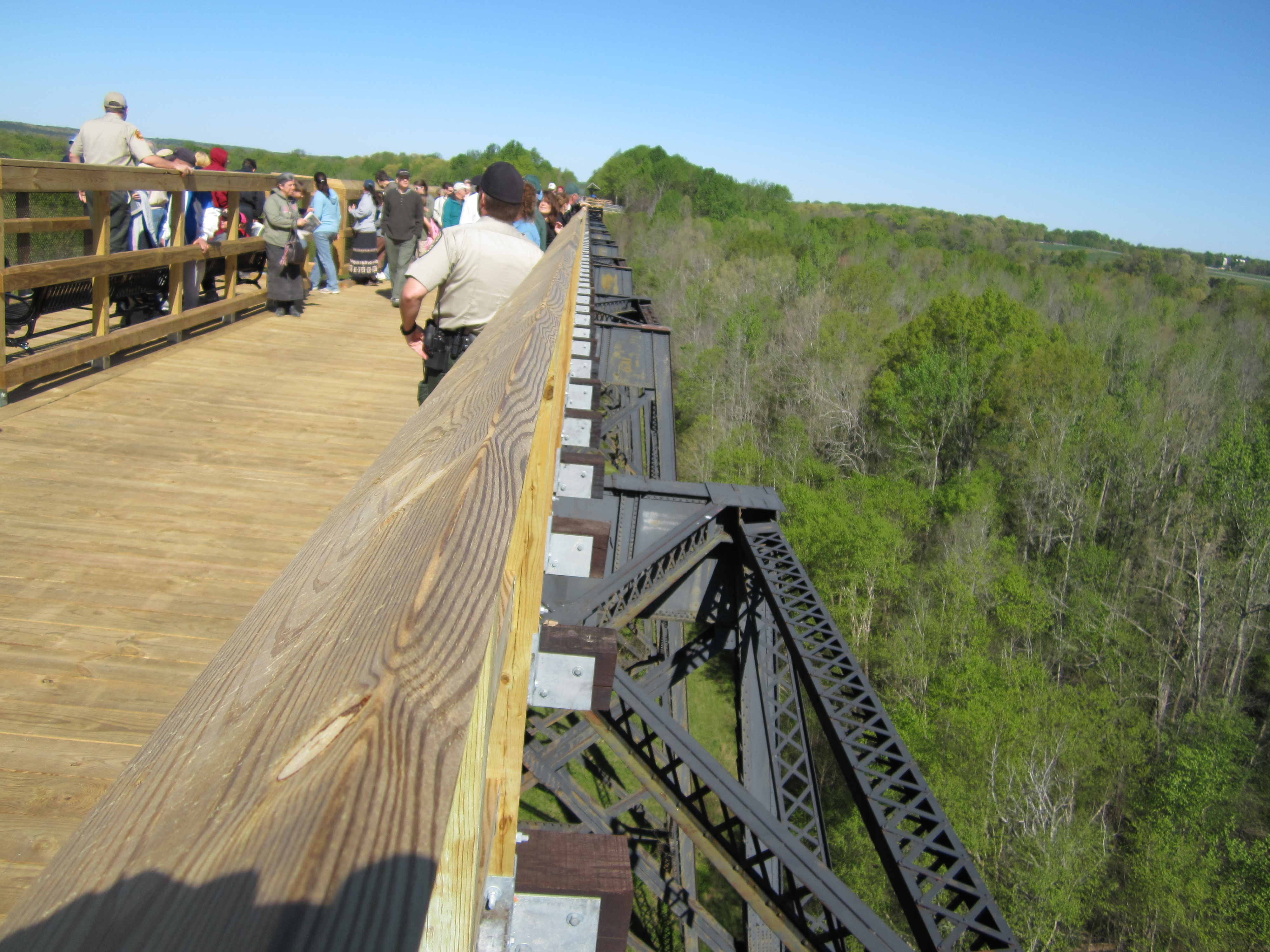
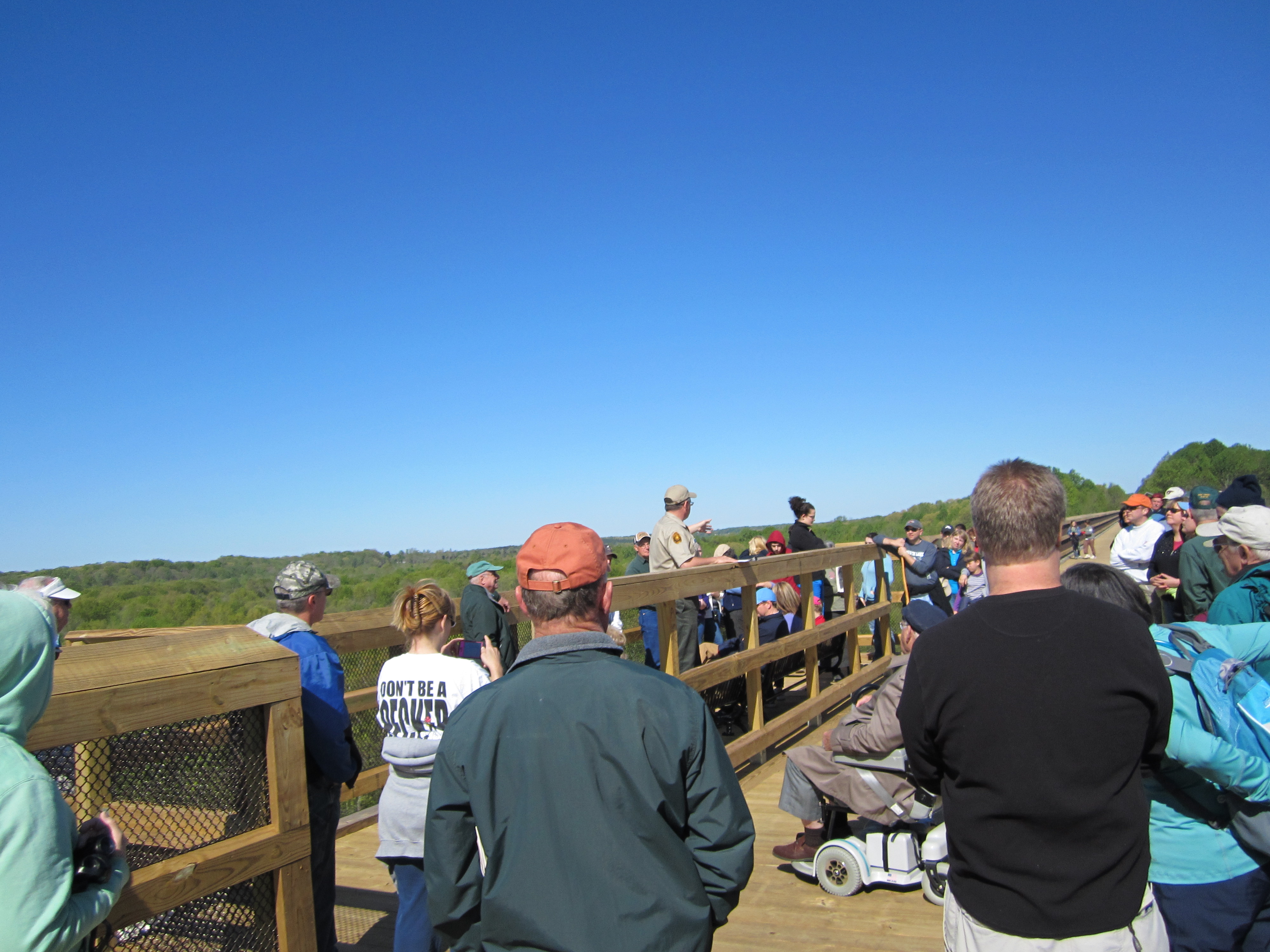
Very shortly, along a slight uphill grade, we arrive at the western end of the bridge just as Park staff is getting a group of close to 100 (mostly hikers) assembled for a group picture. It’s not a Grand Opening or Dedication (the Park Manager informed me that they will have one, yet to be scheduled, sometime in May), but one of the Rangers welcomes us and launches into an amplified talk on the history of the bridge. He went into detail on the battles that took place during the very last days of the Civil War, as the retreating Confederates were being hotly pursued by Union troops and tried to burn the railroad bridge (and the wagon bridge down below) behind them to keep their pursuers from crossing the Appomattox. (History buffs should Google Battle of High Bridge for details of the action.) They did burn two of the five spans of the high bridge, but the Union troops took the wagon bridge, and although they slowed the Union forces, Lee was forced to surrender at Appomattox Courthouse two days later. The Ranger gave an excellent talk, which was well received by the audience, as he moved from the first to the second, and then to the third of the Overlooks on the Bridge.
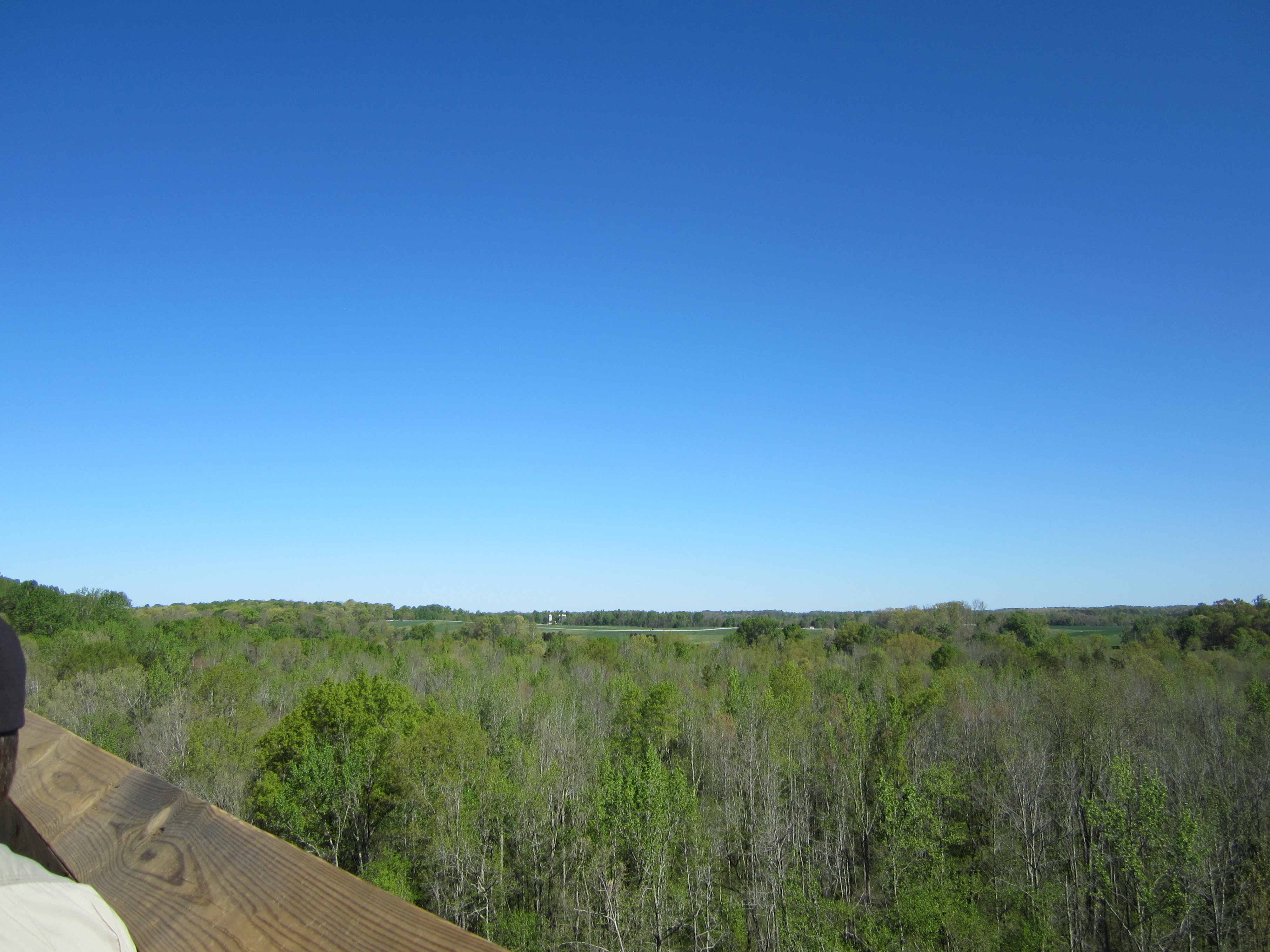
As he wrapped up his talk, we headed on to the eastern end of the trail, 10 miles further, where it stops abruptly, just short of the town of Burkeville, but with no access to it. Nice restrooms spotted strategically along the way, but no drinking water or stores, so bring your own provisions. As I found with the western segment, the trees have filled in very thickly on either side of the old railroad right-of-way (which was donated to the State by NorfolkSouthern in 2006 after they had abandoned this spur about a decade earlier) so that primarily what you see are the trees even though there are a few adjacent farms along the way. Occasionally, you see vestiges of the old rail line with mile markers, (N 147, etc. indicating that many miles from Norfolk), W signs (ordering the engineer to blow his whistle at that point), and remnants of the old telegraph line alongside. One of our party characterized the lack of sights to see as “boring”, and, as befits a railroad line, almost flat with very slight up and downhill grades. The return trip (right around 15 miles back to Farmville) was uneventful, with few others on the trail until we got back to the bridge, where the crowd had thinned out appreciably. A cool but pretty day. Fun to see the bridge after waiting for so long, and a very pleasant and tasty lunch at Charley’s, on the deck right above the Appomattox. Now we’ll have to put a group together to do the western end, starting from Farmville, which will be another trip of about 31 miles, to which we could add 9 out to the bridge and back at either the beginning or end.
Below is the official press release.
FOR IMMEDIATE RELEASE
Date: April 05, 2012
High Bridge to open Friday, April 6
High Bridge in Prince Edward and Cumberland counties, the centerpiece of High Bridge Trail State Park, will open Friday, April 6. The bridge has been under construction since March 2011 converting it from an abandoned railroad bridge to a pedestrian, bicycling and equestrian-friendly one.
Site of one of the last battles of the Civil War, the bridge is 2,400 feet long and towers 160 feet above the Appomattox River. It is the final link in connecting 31 miles of linear state park. It is the most prominent of numerous cultural and historic areas connected by the park. Efforts are still ongoing to extend the park into Burkeville on its eastern end and Pamplin to the west.
High Bridge is located approximately 4.5 miles from downtown Farmville. The park entrances closest to the bridge are Rice’s Depot Road, one-quarter mile off U.S. 460, approximately three miles east of the bridge and on River Road, three miles from N. Main Street in Farmville; approximately one mile west of the bridge. As the closest access to the bridge, carpooling is encouraged for the River Road lot. Bicyclists may want to embark from Farmville or Rice.
For more information on High Bridge Trail State Park go to www.virginiastateparks.gov then click on “Locations” and “High Bridge Trail State Park;” or call the park at (434) 315-0457.

Comments on this entry are closed.
http://www.wset.com/story/17353704/historic-high-bridge-opens-in-farmville
The High Bridge itself is fantastic! A ranger told me that more than 15,000 visitors came the first weekend. I didn’t ride the trail, but the crushed gravel trail seems to be ideal. We’re going back and combining with a campout at Bear Creek Lake SP.